Back up to top menu....
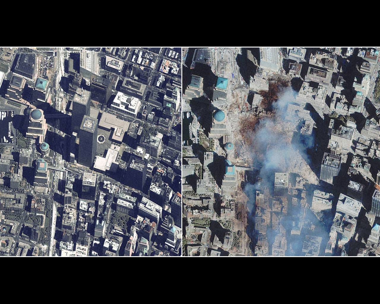
Here is a side by side picture of the World Trade Center site.
Close up Satellite Image of World Trade Center
Area before 9/11
Side-by-Side Satellite Image of World Trade Center Area
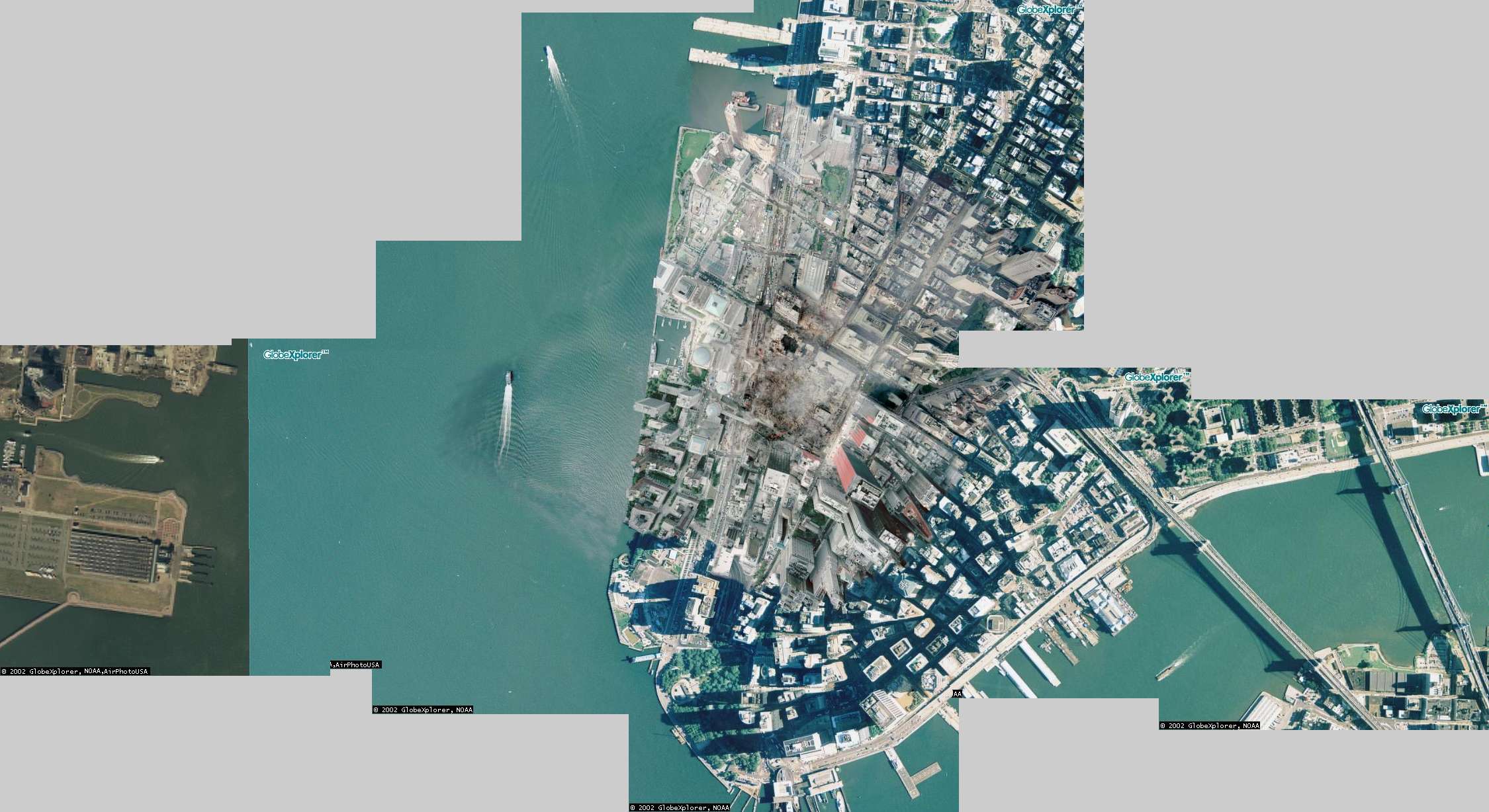
Large Image of Liberty State Park in New Jersey and Lower
Manhattan
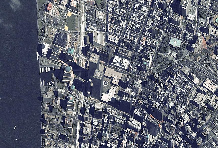
Map of Liberty State Park in New Jersey and Lower Manhattan
This is what the World Trade Center area looked like before September 11, 2001.
This page may take a while to load - but hopefully you will find it useful and
get an idea of what that area of Manhattan looked like and what it looks like
now. Also it may help to give you an idea of where some of the pictures on the
website were taken.
Back up to top menu....
Here is a side by side picture of the World Trade Center site.
This will give you an idea of the area of destruction. The left is Liberty State
Park in New Jersey (it's from an older satellite image), you can see the area
where people catch the Ferry for the Statue of Liberty and Ellis Island on the
New Jersey side. Across the Hudson River is Manhattan Island where the Twin
Towers once stood. The very lower tip of Manhattan is Battery Park. To the far
right you can see the Brooklyn and Manhattan Bridges. I hope this gives you
an idea of what this area looks like. I will be including a marked up image
to descibe the area, buildings and main landmarks.
Here is a rough map of the area. The blank area below Vesey Street is where
the Twin Towers once stood. You can see what a hole that puts in Lower Manhattn
without those buildings.